


1st Precinct, Rock County, Nebraska
About
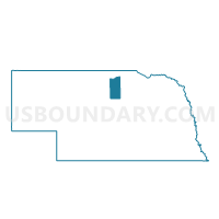
Outline

Summary
| Unique Area Identifier | 613776 |
| Name | 1st Precinct |
| County | Rock County |
| State | Nebraska |
| Area (square miles) | 284.30 |
| Land Area (square miles) | 283.93 |
| Water Area (square miles) | 0.37 |
| % of Land Area | 99.87 |
| % of Water Area | 0.13 |
| Latitude of the Internal Point | 42.63098150 |
| Longtitude of the Internal Point | -99.38311700 |
Maps


Graphs
Select a template below for downloading or customizing gragh for 1st Precinct, Rock County, Nebraska


Neighbors
Neighoring Voting District (by Name) Neighboring Voting District on the Map
- 2nd Precinct, Rock County, NE
- 3rd Precinct, Rock County, NE
- 5th Precinct, Rock County, NE
- Basin - McCulley - Butte Precinct, Boyd County, NE
- Custer Precinct, Keya Paha County, NE
- Mills Precinct, Keya Paha County, NE
- Precinct 2, Holt County, NE
- Precinct 7, Holt County, NE
Top 10 Neighboring County Subdivision (by Population) Neighboring County Subdivision on the Map
- Bassett precinct, Rock County, NE (903)
- Stuart township, Holt County, NE (876)
- Custer precinct, Keya Paha County, NE (273)
- Mills precinct, Keya Paha County, NE (266)
- Basin township, Boyd County, NE (228)
- Newport precinct, Rock County, NE (141)
- Green Valley township, Holt County, NE (79)
- Blaine precinct, Rock County, NE (62)
- Kirkwood precinct, Rock County, NE (54)
- Center precinct, Rock County, NE (45)
Top 10 Neighboring Place (by Population) Neighboring Place on the Map
Top 10 Neighboring Unified School District (by Population) Neighboring Unified School District on the Map
- Ainsworth Community Schools, NE (3,139)
- West Holt Public Schools, NE (2,484)
- Rock County Public Schools, NE (1,530)
- Stuart Public Schools, NE (864)
- Keya Paha County Schools, NE (826)
Top 10 Neighboring State Legislative District Upper Chamber (by Population) Neighboring State Legislative District Upper Chamber on the Map
Top 10 Neighboring 111th Congressional District (by Population) Neighboring 111th Congressional District on the Map
Top 10 Neighboring Census Tract (by Population) Neighboring Census Tract on the Map
- Census Tract 9741, Holt County, NE (2,564)
- Census Tract 9758, Boyd County, NE (2,099)
- Census Tract 9740, Holt County, NE (1,645)
- Census Tract 9746, Rock County, NE (1,526)
- Census Tract 9754, Keya Paha County, NE (824)